Map(地图(Map))
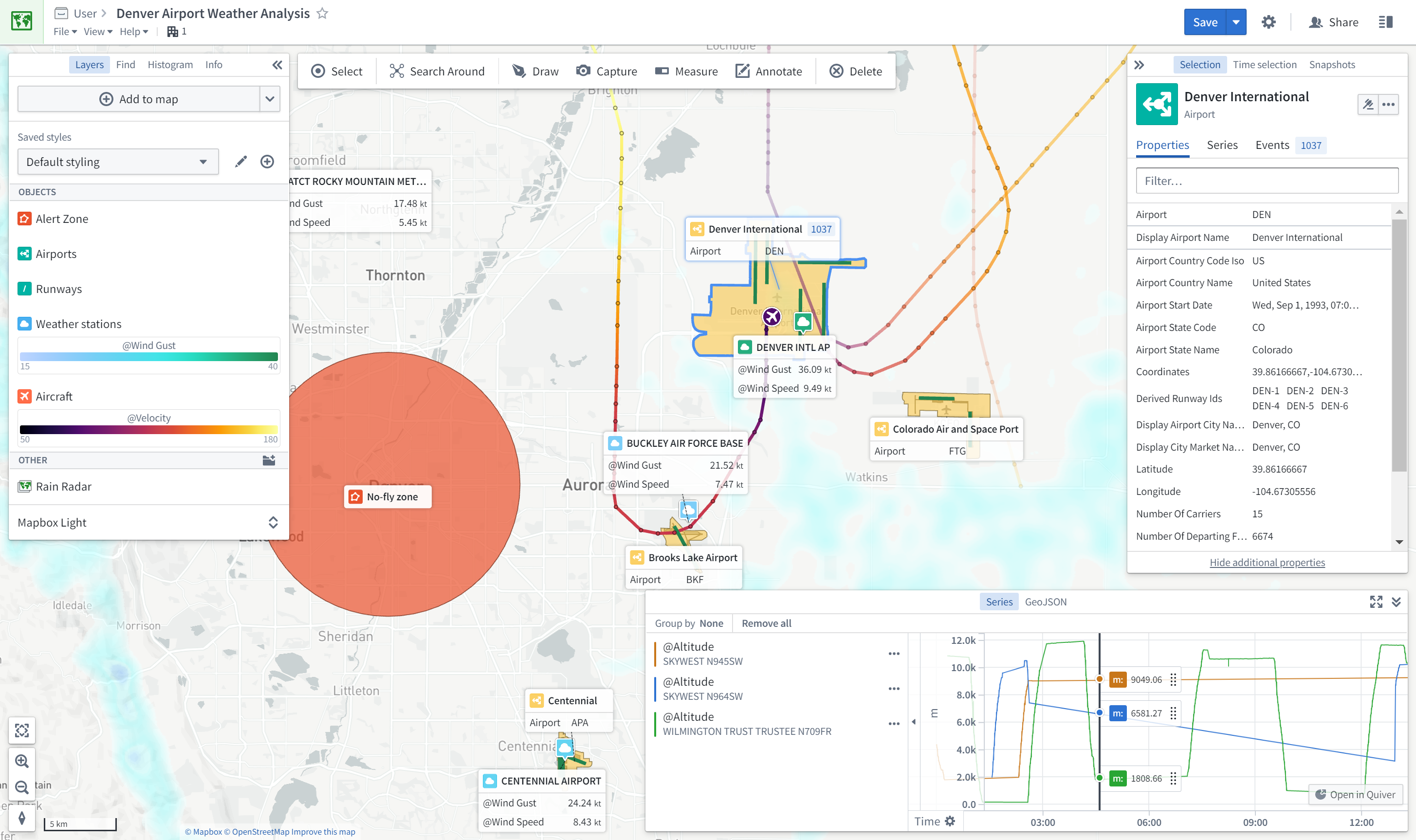
The Map application provides powerful geospatial and temporal analysis and visualization capabilities, allowing you to integrate data from across Foundry into a cohesive geospatial experience:
- Explore connections between geospatial objects, traverse physical networks.
- Search geospatially for point and polygon data, using bounding box and polygon intersection queries.
- Visualize contextual geospatial data from a variety of sources, including high-scale vector data and satellite imagery, and temporal data such as paths of object movements over time, and events.
- Interact by drawing shapes and performing geospatial actions.
- Build geospatial applications using map templates.
Geospatial data on the Map
The Map application renders maps using the Web Mercator Projection ↗ (EPSG:3857), and expects latitude/longitude coordinates in WGS 84 degrees (EPSG:4326). See Geospatial data in Foundry for more information on transforming geospatial data in Foundry.
中文翻译
地图(Map)
地图应用提供强大的地理空间(geospatial)与时间(temporal)分析和可视化功能,使您能够将整个Foundry中的数据整合到统一的地理空间体验中:
- 探索地理空间对象之间的关联,遍历物理网络。
- 使用边界框(bounding box)和多边形相交(polygon intersection)查询,对点数据和面数据进行地理空间搜索。
- 可视化来自多种来源的上下文地理空间数据,包括高比例矢量数据(high-scale vector data)和卫星影像,以及随时间变化的物体运动轨迹、事件等时间数据。
- 通过绘制图形和执行地理空间操作进行交互。
- 使用地图模板构建地理空间应用。
地图上的地理空间数据
地图应用使用Web墨卡托投影 ↗(EPSG:3857)渲染地图,并要求经纬度坐标采用WGS 84度(EPSG:4326)。有关在Foundry中转换地理空间数据的更多信息,请参阅Foundry中的地理空间数据。