Geospatial time series use case(地理空间时间序列用例)
Geospatial time series properties on objects enable you to track the location of entities over time. Review the geospatial documentation to decide if a geotemporal series or time series set up is right for your use case.
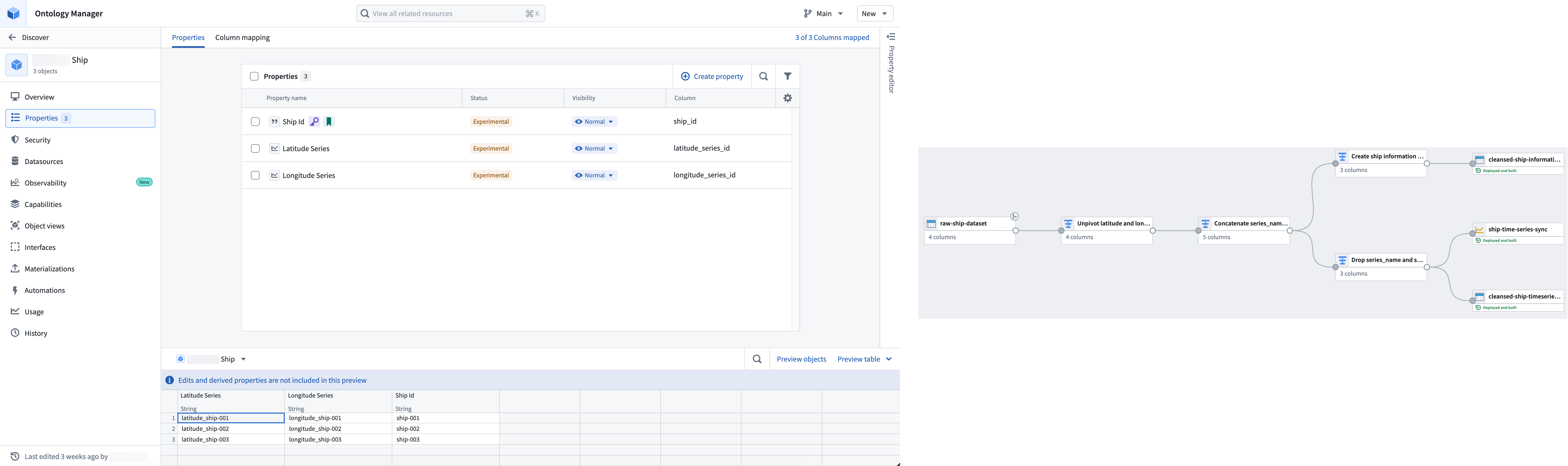
This documentation walks you through the steps to prepare time series data in Pipeline Builder, configure objects in Ontology Manager, and visualize entity tracks on a map using an example Ship object type. The Ship object type has two backing datasets containing information about each individual ship, such as its Ship Id, and location updates over time expressed as latitude and longitude values with timestamps.
The following guides will lead you through the steps to create objects with geospatial time series data and visualize them on a map:
- Use Pipeline Builder to prepare time series and object backing data
- Add time series properties and configure geospatial capabilities with Ontology Manager
- Visualize a ship's tracks on a map
中文翻译
地理空间时间序列用例
对象上的地理空间时间序列属性使您能够追踪实体随时间变化的位置信息。请查阅地理空间文档,以确定地理时间序列或时间序列设置是否适合您的用例。
本文档将通过一个示例Ship对象类型,引导您完成在Pipeline Builder中准备时间序列数据、在Ontology Manager中配置对象,以及在地图上可视化实体轨迹的步骤。Ship对象类型包含两个支撑数据集,分别存储每艘船舶的详细信息(如Ship Id)以及随时间更新的位置数据(以带时间戳的经纬度值表示)。
以下指南将引导您完成创建具有地理空间时间序列数据的对象,并在地图上实现可视化的步骤: